Ground Penetrating Radar
Ground Penetrating Radar in Southwest Florida
GPR scanning support to help identify buried utilities, private lines, conflicts, and risk areas before drilling, boring, trenching, or excavation.
Before underground work begins
Find conflicts before the route is opened
Ground penetrating radar, often called GPR, helps locate and identify underground conflicts before boring, drilling, trenching, or excavation begins. It can be used to support route planning when private utilities, unknown lines, irrigation, conduit, drainage, or other buried features may not be fully marked by standard public utility locate tickets.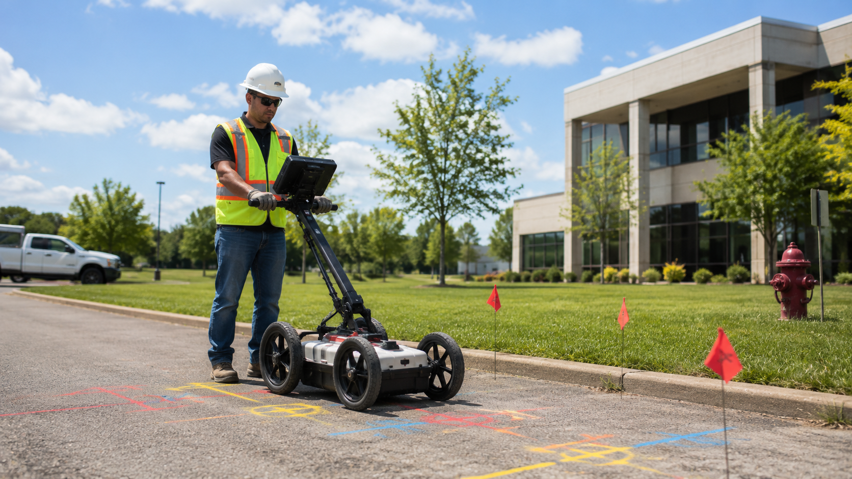
Public utility marking is important, but it may not cover every private line on a property. GPR can help contractors, electricians, property managers, homeowners, and project crews make better decisions before choosing directional drilling, missile boring, trenching, or conduit installation.
GPR is especially useful when the route crosses commercial sites, parking lots, landscaped areas, older properties, utility-heavy areas, or locations where previous underground work is uncertain. The goal is to reduce surprises before the ground is opened.
GPR does not replace every form of utility locating, and site conditions can affect what is visible underground. When paired with private utility locating, route review, and proper 811 procedures, it can provide valuable planning information before underground work begins.
Where GPR helps
Private lines, unknown utilities, and risk areas
Ground penetrating radar can support underground utility projects by helping identify possible buried conflicts such as private utility lines, conduit, drainage, irrigation, old utility paths, and other subsurface features. It is most valuable when project records are incomplete or the site has a history of previous underground work.
GPR is often used before trenching, boring, directional drilling, excavation, handhole installation, or conduit routing. It helps the team plan safer entry points, adjust the route, and reduce unnecessary delays.
Bravo Bores uses GPR as part of a practical planning process. The goal is to understand the site before recommending the underground method.
Route planning matters
What to send before we estimate the work
For the best estimate, send the project address, start point, exit point, surface type, approximate route length, utility or conduit goal, and photos that show access or obstacles. Clear information helps us determine whether the project needs drilling, boring, trenching, conduit installation, locating, GPR, pipe fusing, handholes, or a combination of services.
Before underground work begins, required utility locates or GPR should be handled. Public utility marking is part of safe digging, and private lines may require additional locating. Florida excavators and property owners can learn more from Sunshine 811, the official Florida 811 resource for damage prevention and locate tickets.
How projects move
From route review to installation
Most projects start with a quote request, email, or call. Bravo Bores reviews the location, route, surface conditions, access, service goal, and photos if available. Once the estimate is approved, required locates or GPR are completed before underground work begins.
During installation, the route is drilled, bored, trenched, fused, located, or prepared for the next trade based on the service needed. The cleaner the route planning is at the beginning, the easier it is to reduce delays, avoid unnecessary restoration, and keep the underground work practical for the site.
Ground Penetrating Radar FAQs
What does GPR help find?
Is GPR the same as utility locating?
Should GPR happen before drilling or trenching?
Southwest Florida
Need an underground utility route planned?
Send Bravo Bores the route, surface type, utility goal, and photos if available. We will review the project and recommend the right underground method.